Logistieke planning kan een ingewikkelde taak zijn. Maar wat als er een dashboard was waarop je kon zien waar jouw werknemers zich bevinden en hoe ver ze van kantoor zijn? Dit zou erg handig kunnen zijn om de uitstoot per medewerker te berekenen. In deze blog laten we je zien hoe je Google Maps kunt koppelen aan jouw dashboard en automatisch de afstand tussen de medewerker en de bestemming kunt berekenen.
Afmetingen
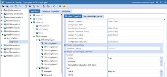
Eerst moeten we elke werknemer aan een stad toewijzen. Dit wordt gedaan in de eigenschappen van tekst 1.
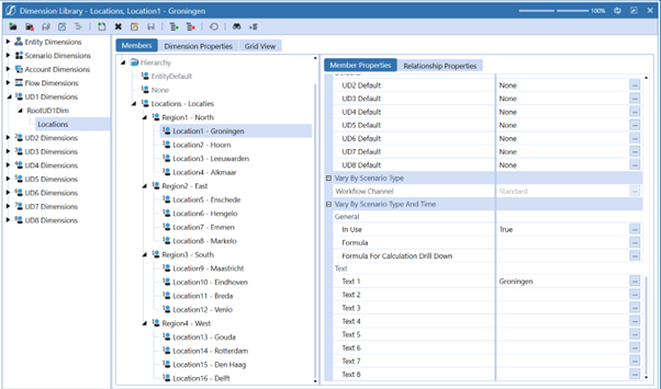
Vervolgens gaan we naar UD1, waar we de locaties invoeren. Deze locaties worden de bestemmingspunten van de werknemers. We zetten opnieuw de naam van de stad in Tekst 1.
Codering
Nadat je de steden hebt ingevoerd, moet je twee Business Rules maken die de Google API ophalen en opslaan in een gegevenstabel. Noem de Business Rules"FXT_TravelDistance_FTD" en"MapPinPoint". De code kan hier worden gevonden.
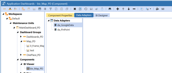
Gegevensadapters
Na het maken van de Business Rules, moet je twee data-adapters maken: een voor de kaart en de andere voor de locatie. je kunt de SQL-query voor da_GoogleData vinden
hier.


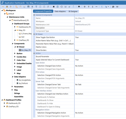
BI-viewer
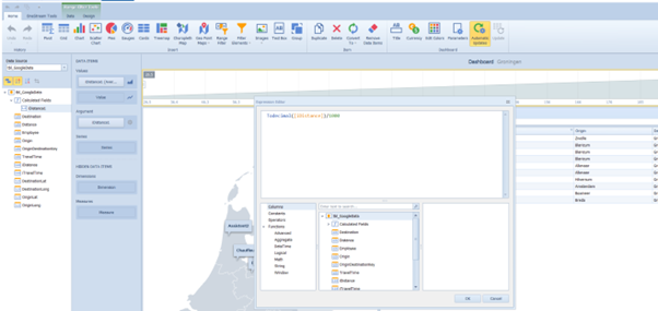
Nadat je de twee data-adapters hebt gemaakt, maak je een BI Viewer met de naam biv_Map_PD. Deze BI Viewer zal de twee data adapters bevatten. Vervolgens moet je de BI Viewer ontwerpen. In onze BI Viewer kunnen we instellen welke afstand we willen weergeven tussen de bestemming en de werknemers. Dit is een berekend veld.

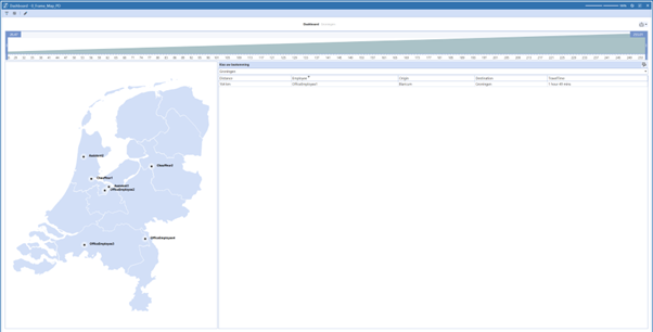
Eindresultaat
Plaats de BI Viewer onder een dashboard en dit zou jouw eindresultaat moeten zijn: